
Plan a Visit

General Info
Hours: Sunrise to Sunset daily
FREE Admission: $3 per person suggested donation
Before visiting the Preserve, please review our policies. Professional photographers and large groups are required to register.
Conestee Nature Preserve is owned and operated by a nonprofit. Donations go directly to the Preserve and its programs.
Join Friends of the Preserve! You'll cover your admission donation for the year, enjoy great perks, and support CNP!


Mobile Guide
Try our mobile guide! Be sure to enable location services. Features include an interactive map to show your location and inspire new destinations, fun on the trail, news on what's happening, ways to get involved, links to our store and more! Content is updated often so check back in! Best viewed on a mobile device.

Plan Your Route
With its diverse habitats and varied trails, we offer many opportunities for discovery. Our trail guide has broad descriptions of our routes so you can plan the perfect visit. Trails range from flat, paved surfaces suitable for all mobility levels, to steep natural paths. Your trip can be tailored to match any experience you seek.
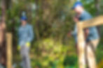
Entrances and Parking
This 640-acre Nature Preserve has five entrances, so your first decision is where to start your exploration!


Policies for Visiting
Group Visits (10+ Visitors)
To ensure positive experiences for ALL visitors, organized groups of 10 or more people MUST register in advance by completing this FORM. Organized groups could include: classes that did not book a field trip, youth camps, church groups, scouts, homeschool groups, hiking clubs, etc. This especially includes ANY group that charges it's participants and is thus, profiting from their use of the Preserve.
This policy does not apply to multiple families and/or friends meeting up for a casual visit together.
Some groups will be subject to a $5 per person fee, while others, like nonprofit partners, or groups that do not charge their participants, may be eligible for the fee to be waived. Registration is required regardless, and staff may request proof during your visit.
Photographers
While casual photography for personal use is welcome, professional photography sessions (e.g., family portraits,
engagement, senior, wedding-related sessions, commercial shoots, or any photography where a fee is charged or images are sold) require advance coordination and approval. Please read the full policy and submit an inuqiry below.
Prohibited Activities
The following activities are not allowed:
- Feeding wildlife
- Hunting
- Fishing
- Playing amplified music
- Driving motorized vehicles
- Lighting fire
- Consuming alcohol
- Camping
- Carrying a weapon
- Flying a drone
No Fishing
Fishing of any kind is prohibited in our Preserve.
Legacy Contamination
In the distant past, Lake Conestee was a receptacle for Greenville’s industrial waste. While that waste poses no risk to normal users of the Preserve, it does necessitate the prohibition of fishing, boating, and swimming.
Dogs
Dogs are allowed in the Preserve, but they must remain leashed at all times! Please clean up after them.
Bikes
Outside of the Brushy Creek Tract where our Mountain Bike Trails are found, bikes are allowed only on our paved trails.
Highlights and Features


Trail Closures and Repairs
The boardwalk connecting the Swamp Rabbit Trail on our Brushy Creek tract to the Swamp Rabbit Trail near ReWa is still closed.
Want the latest information on trail closures while you’re in the Preserve? In addition to following Conestee Nature Preserve on Facebook and Instagram for announcements and signing up for the monthly Newsletter, the Interactive Map on our Mobile Guide is the best way to get all the information you need! (Best viewed on a phone.) Be sure to allow it to use your current location.

Flat Tail Fund

Just like Conestee’s beavers, staff is relentless in maintaining the trails, decks, and boardwalks you enjoy in the Preserve, even when floodwaters rise, trees fall, or other damage occurs. But your help is needed! With your monthly support through Flat Tail Fund, the Trails Team can always be ready “when the dam breaks!"
Want your dog to be the best behaved pup in the Preserve?
Our friends at Dog Training Elite have you covered.
Visit dogtrainingelite.com/greenville or call 864-863-3647 to learn more.
.png)
Where Education Meets Excellence.
Elite Methods. Elite Results.